
In this context a file of an official surveying dossier means a digital file that has been created during the procedures undertaken by an official surveyor, where surveying data is processed in a GIS system to update the cadastral database and to produce the surveying plan. These files may be useful for architects and consulting engineering bureaus when working on their projects. The Administration du Cadastre et de la Topographie offers these files in 2 formats, the DWG format and the STAR format.
To order such data, please use the online-shop of the geoportal.
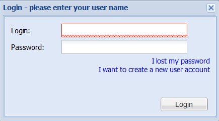
Log in with your geoportal user login and the corresponding password. In case you do not yet have a geoportal user account, you can create a new one here.
You arrive in the order channel, where you first choose the product category ("Specific product") ....
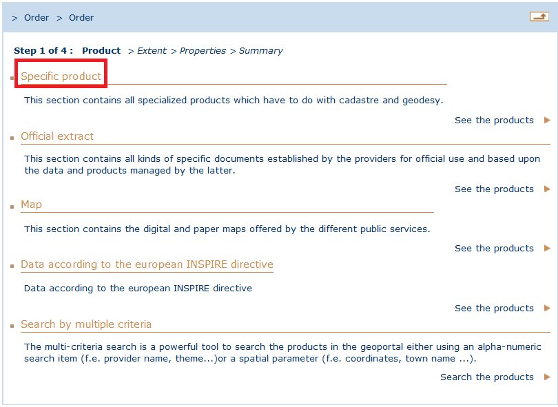
... and the product ("File of an official cadastral surveying dossier") :

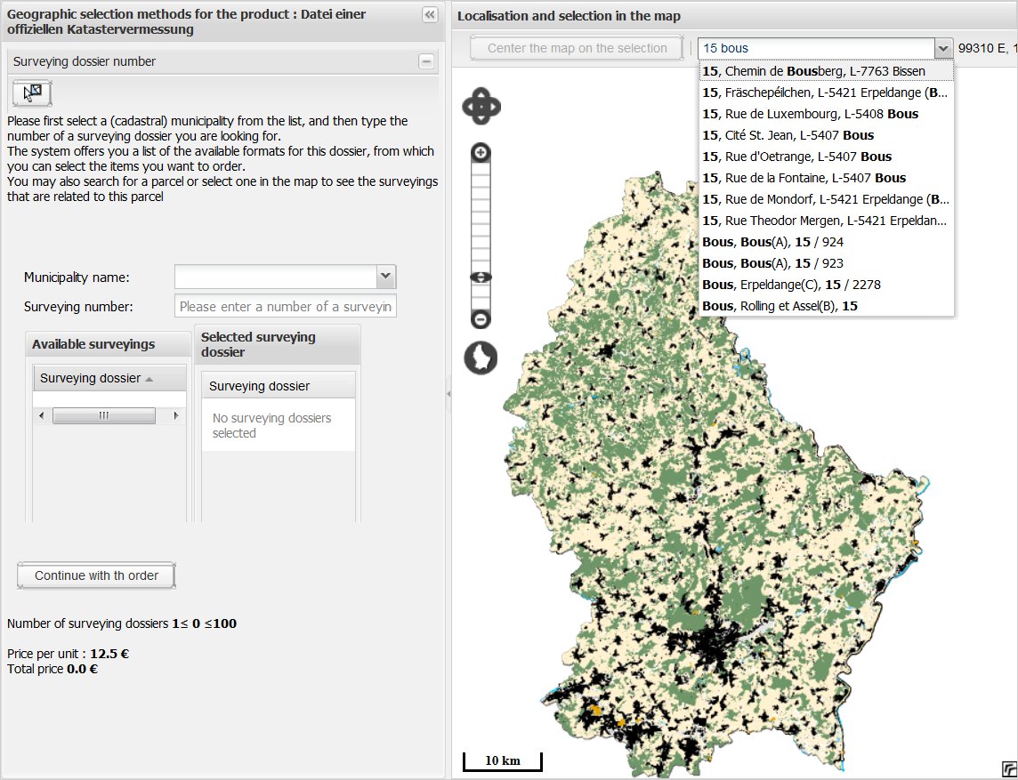
Then in the 2nd step, you have to select the surveying dossier you need. The most common approach is to first select the parcel(s) and to have the system search for the existing surveying files. As shown in the picture below, you can for example use the search field on top of the map window to enter an address or a parcel number:
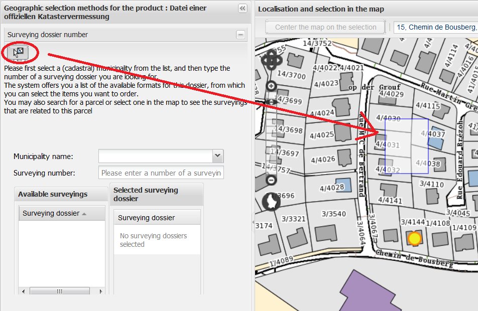
Then use the button on your right side to activate the graphic selection and click in the map to select a parcel (or hold down the left mouse button to multi-select more than one parcel with a rectangle):
The geoportal then searches the existing surveying dossiers and shows them in the list. You select the items by doiuble-clicking on them in the list :
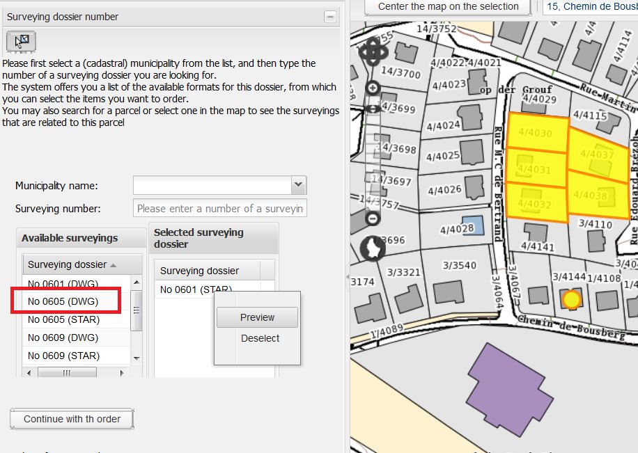
Because it is not sure that the file meets your requirements (as f.e. some borders or buildings you need may not be covered by it), there is a "Preview-Function" that shows you the content of the file. Click on the dossier with the right mouse-button and choose "Preview".
Another way to identify the surveyings is to directly search for the surveying number. You have to use the dedicated fields to indicate the cadastral municipality and the dossier number.
After having selected the surveying files, you can proceed as usually with the order in the geoportal shop.
In case there does not exist any surveying for your parcel(s), it may be necessary to call for an official surveyor to fix the parcel limits, survey the area and make an offical plan, that clearly shows the parcel's limits.